As you have seen elsewhere in this course, it's not all that difficult for the history of a region or a people to get lost or hidden. For hundreds of years, the eastern or Swahili coast of Africa was critical to a thriving trade across the Indian Ocean. Traders from India and Arabia came to southeast Africa for ivory, rhinoceros horns, tortoise shells, and gold. They brought with them spears, glass, spices, and other trade goods.
The Swahili language itself grew into a lingua franca, or common tongue, among the Arab, Persian, and African traders on the coast. The Swahili ports of Mogadishu, Kilwa, Zanzibar, and Rhapta were important sites of this trade in ivory, gold, ebony, and slaves. Historians are turning to an ancient Greek guide to southeast Africa called the “Periplus of the Erythraean Sea,” or the Periplus, which describes the trading ports along the east coast of Africa (the “Erythraean Sea” is today’s Indian Ocean).
The “Erythraean” Trade
Effects of Trade
Great Zimbabwe
The Lost City of Rhapta

PHGCOM [GFDL (http://www.gnu.org/copyleft/fdl.html) or CC-BY-SA-3.0-2.5-2.0-1.0 (http://creativecommons.org/licenses/by-sa/3.0)], via Wikimedia Commons
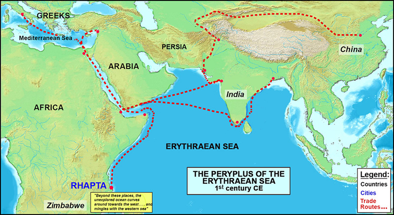
This map shows the ancient trade routes described in the Periplus as historians believe they existed in the first century CE. Trade stretched from the Silk Road in China to India, then across the sea to Arabia and Africa, and finished its long journey in Rome. Rhapta and China represented the farthest extremes of the trade for the Greeks; China was the eastern edge of the known world, and Rhapta was the southern edge.
Where did the author of the Periplus get his information about these faraway places?

He likely talked with the traders who came to Greece, who told him where their goods had come from.

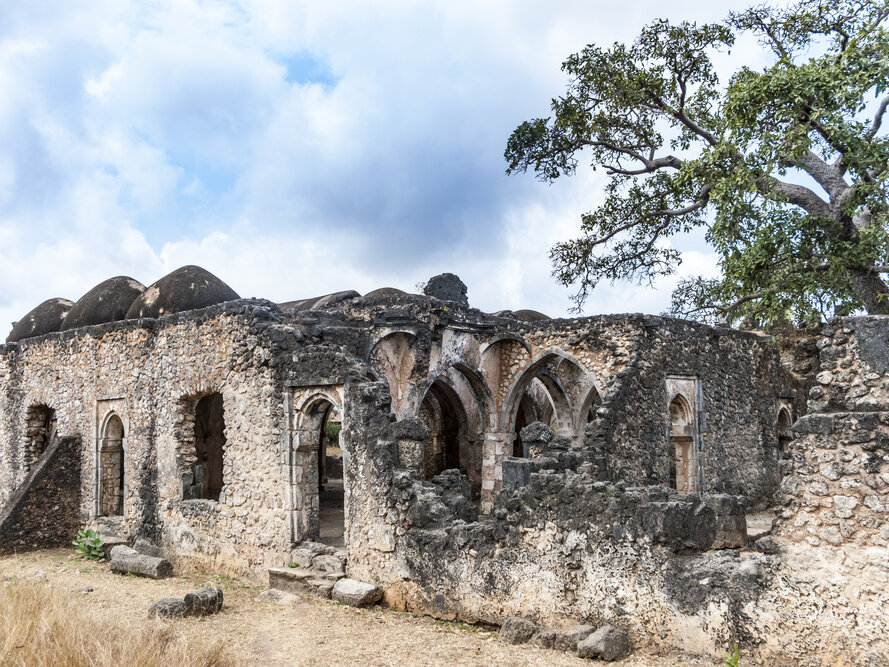
The ruins of the Great Mosque of Kilwa in Eastern Africa demonstrate the spread of Islam to the Swahili coast.
The Erythraean Trade brought more than goods to Eastern Africa—it brought new ideas and cultures along with economic growth. Islam became a major religion along the Swahili Coast, blending with African traditions to create a unique culture. This cultural exchange made the Swahili Coast a melting pot of African, Arab, and Asian traditions. The Swahili trade network also made cities along the coast very wealthy. These cities became bustling centers of commerce, attracting merchants from around the world. The trade also brought new technologies, such as shipbuilding techniques and advanced navigation tools, which improved African trade networks even further.
What was the impact of the Swahili trade network on East Africa?

The Swahili trade network brought wealth, spread Islam, expanded the use of the Swahili language, and connected East Africa to Asia and Arabia.

Image taken by Jan Derk in 1997 in Zimbabwe. (en:Image:Great-Zimbabwe-2.jpg) [Public domain], via Wikimedia Commons
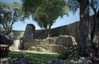
This photo shows the ruins of the wall around the ancient city of Great Zimbabwe. The walls are 16 feet tall, and historians believe they protected the royal palace of the Zimbabwean king. The oldest ruins date to the 11th century CE, and the city seems to have been at its peak between the 1200s and the1500s. Great Zimbabwe may have controlled the gold and ivory trade, making the city very wealthy.
Who built the city of Great Zimbabwe?

The Shona people, who lived in many different kingdoms in southeast Africa

By J. Patrick Fischer (Own work) [GFDL (http://www.gnu.org/copyleft/fdl.html) or CC-BY-3.0 (http://creativecommons.org/licenses/by/3.0)], via Wikimedia Commons
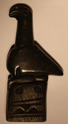
Rhapta was the southernmost point of Africa so far as ancient traders were concerned. It was the last great trade city Erythraean traders visited before turning north on their way to the Mediterranean and the Middle East. This photo shows the Zimbabwe Bird. These large carvings were placed on top of columns around Great Zimbabwe, and are believed to have symbolized the presence of the king. Foreign traders would have conducted business under the watchful eyes of Zimbabwe Birds like this one.
Where are the ruins of Rhapta?

Historians are not sure. Excavations have begun at a few sites that might turn out to be Rhapta.
Question
What does the Periplus reveal about the earliest African ports of trade?
