One thing missing from our analysis so far is a look at any maps or images that could help us visualize what happened at the battle of Puebla. (While paintings and maps are usually secondary sources, they can reveal critical details that fill in gaps in our analysis.) This map of Puebla shows the terrain of the battle and the placement of defensive forts. The lines surrounding Fort Loreto and Fort Guadalupe on this map show that they both occupy the high ground north of the city, and that any invaders would have to cross a trench between them.
When the French Army first attacked Puebla in May of 1862, they did so from the north and were defeated. During the Second Battle of Puebla in March of 1863, the French Army attacked from all sides and managed to take the city. Looking at this map, can you see why it might have been a mistake to attack Puebla from the north?
Question
Why was it a mistake for the French forces to attack from the north?
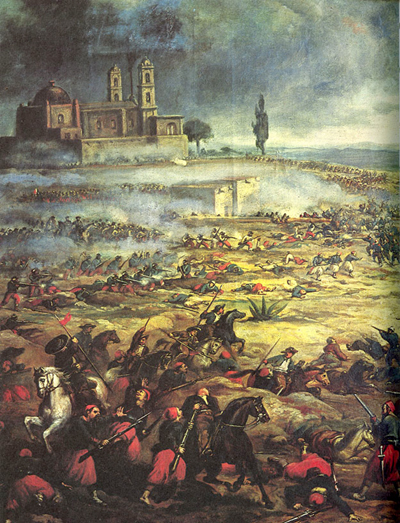
This painting depicts the battle of Puebla, with the French soldiers in red and the Mexican Army on horseback. You can see the city on the hill on the upper left of the painting. Click on the painting to enlarge it and answer the following questions: What do you notice about the condition of the French Army? What about the Mexican soldiers? What weapons is each side using? How accurate do you think this portrayal is? What mood is the artist trying to create?
Question
What mood or tone is the artist trying to create with his painting?